Felker Quarry
Tags:
Quarry,
Stoney Creek
Date Built: 19th Century
Date Destroyed: Unknown
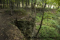
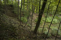
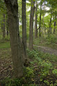
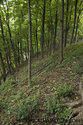
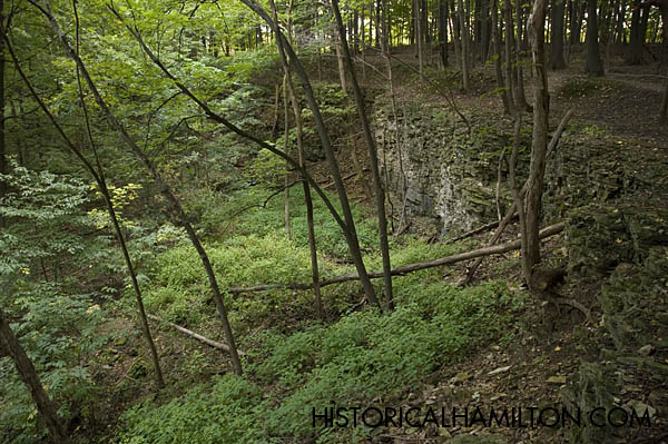
This 19th Century limestone quarry also known as the "bowl" is located at the edge of the Niagara Escarpment just east of Felkers Falls and west of Centennial Parkway. Situated just to the west of where the abandoned northern reach of 2nd road west and Glover Mountain roads joined. Also the quarry is encompassed in the Nash Neighbourhood. Unlike the modern quarries in the area being located at the edge of the Eramosa Escarpment, this quarry was located directly on edge of the Niagara Escarpment itself.
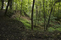
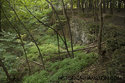
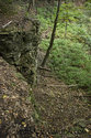
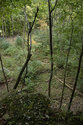
It is unknown when this piece of land was first quarried and when the operations had ceased, we do know that it was running in the 19th century. The quarry itself is approx 70 x 70 meters inside. The top loose glacial rock had been removed from a depth of 2 to 10 feet. Then quarrying operations began on the bedrock of the Escarpment itself. There is a strip of land encircling the edges of the quarry that is slightly lower than the surrounding land. This is due to the removal of loose rock. The quarry hole is 7-15 meters deep and is enclosed by sheer cliffs in all directions except the northern face which actually spills over the edge of the escarpment. The bottom of the quarry hole is flat and is level all the way out to the escarpment edge.
On this "Plateau", on the outside edge of the escarpment, northeast of the quarry hole itself was a rock elevator. Made up of two concrete foundations, one on the ground and one held up by four concrete bases, they formed the upper part of the elevator. All that remain is the concrete foundation. There used to be a coal pile just behind these structures, on the east side of them. This powered the elevator which brought rock from the quarry pit, down the escarpment through a small earthen trough. At the very bottom of the escarpment is a sheer wall built into it which the rock went over. A heavy metal cable was used to pull the elevator down the escarpment.
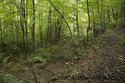
Quarrying operations stopped in the south-eastern portion where rock still remains within the pit. There are a number of trenches near the quarry, some running in a straight line and then turning 90 degrees. Others run parallel to each other with a rise between and head towards the quarry pit. Evidence of a gate can be seen to the east of the quarry but this may have been added at a later date. Also, there is an area to the east of the quarry which has residue of used coal. Relatively flat area but upon closer inspection it is in the line of Maple trees which follows a flat depression/road bed which leads right to the edge of the quarry.