Area
Browse Historical Hamilton by geographical area. Including but not limited to neighbourhoods such as: Beasley, Central, Corktown, Durand, North End, Kirkendall, Strathcona, Dundurn, Westdale and including outlying areas like: Ancaster, Dundas, Flamborough, Glanbrook, Stoney Creek

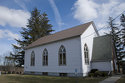
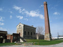
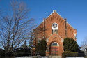
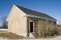
Ancaster
Ancaster is one of the oldest communities in the Hamilton Area. It's many creeks were harnessed to power mills.
Beasley
Beasley is bounded by James Street North to the west, the CN Rail line to the north, Wellington Street to the east and Main Street to the South.

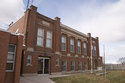
Central
Central is bounded by Queen Street to the west, the CN Rail line to the north, James Street North to the east and Main Street to the South.
Corktown
Corktown is bounded by James Street South to the west, Main Street to the north, Wellington Street to the east and the Niagara Escarpment the South.
Dundas
Dundas is bounded by the Escarpment to the north, Hamilton and Cootes Paradise to the east, and the Dundas Valley Conservation area to the south and west.
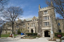
Durand
Durand contains some of the finest examples of residential architecture in Hamilton. It is bounded by Queen Street to the west, Main Street to the north, James Street South to the east and the Niagara Escarpment the South.
Flamborough
Flamborough is bounded by the Niagara Escarpment and the Ancaster Township along Governors Road to the South. Burlington is to the north-east, the boundary is Millburough Line. Puslinch is to the north-west.
Glanbrook
Hamilton Mountain and Stoney Creek Mountain are north of Glanbrook. The boundary lies along Highway 20 in Stoney Creek and just south of Highway 20 in Hamilton. The eastern boundary with the Niagara Region is along Westbrook Road.
Hamilton Centre
Bounded by Wellington Street to the west, the CN Rail line to the north, Gage Avenue to the east and the Niagara Escarpment to the south.
Industrial Sector
Bounded by Wellington Street to the west, Burlington Bay to the north, Parkdale Avenue and the Beach to the east and the CN Rail line to the south.
North End
Bounded by Burlington Bay to the west and north, the CN Rail line to the south and Wellington Street to the east.

Stoney Creek
Contains the village of Stoney Creek, former villages Mount Albion, Winona, Elfrida
The East End
The area now known as the East End was originally rural land belonging partly to Barton and Saltfleet Townships. The City of Hamilton annexed the area in sections in the first half of the 20th century.

The Mountain
The Mountain is bounded on the north by the escarpment, on the west and south by hydro corridors and on the east by the old Stoney Creek border roughly at Upper Mount Albion Road.


Binbrook
The town of Binbrook.

Carluke
Village of Carluke
Mountsberg
Village of Mountsberg

Freelton
Village of Freelton